

Tropical Storm Gonzalo’s Path and Its Impact on the Canary Islands
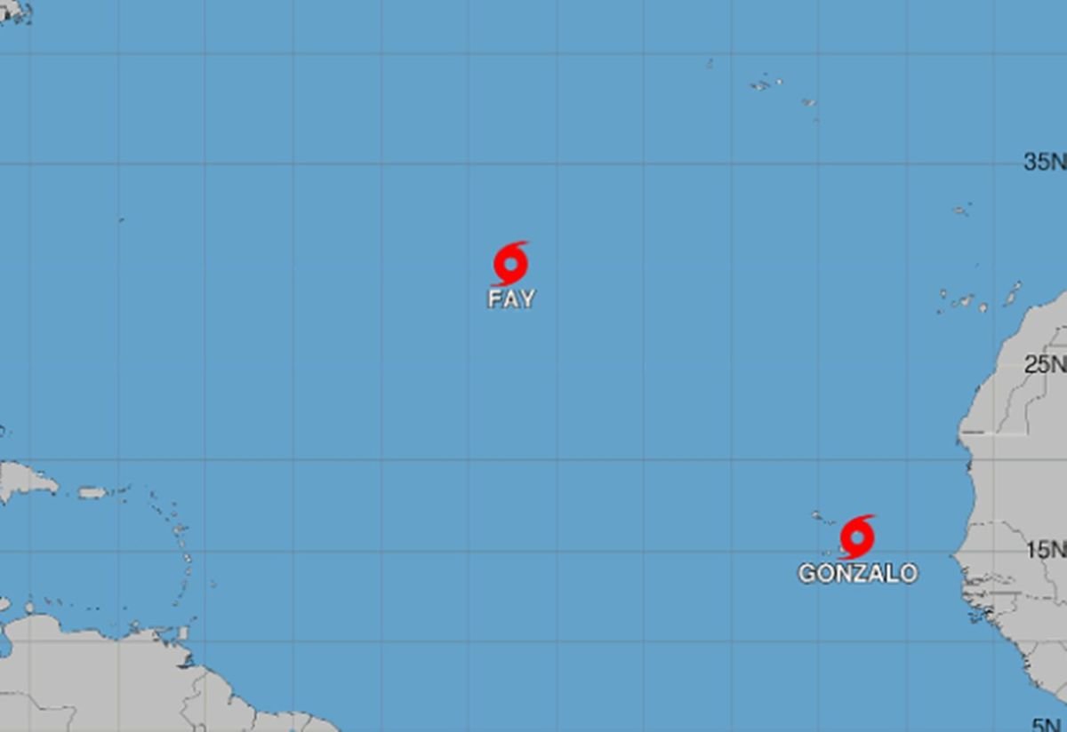
Tropical Storm Gonzalo has formed in the eastern Atlantic, moving north-northwest. While its path brings it closer to the Canary Islands, it is not expected to directly impact the region.
On Friday, Tropical Storm Gonzalo emerged in the eastern Atlantic, heading north-northwest. Despite its trajectory bringing it nearer to the Canary Islands, forecasts indicate it will remain far south-southwest of the archipelago, posing no immediate threat.
The U.S. National Hurricane Center (NHC) reported Gonzalo’s formation early Friday, noting its position about 260 kilometers east-southeast of the southernmost Cape Verde islands, with sustained winds of 75 km/h. The storm is advancing at 13 km/h.
Predictions suggest Gonzalo will continue its movement over the coming days, slowing down over the weekend. Initial strengthening is expected, followed by gradual weakening.
Current forecasts confirm Gonzalo is not a danger to the Canary Islands. Meteorologist Francisco Martín León from Metored indicates the storm will stay well south-southwest of the archipelago.
The NHC anticipates significant weakening before Gonzalo nears the islands, predicting it will drop below tropical storm intensity by Sunday, evolving into a remnant low.
Cape Verde faces a different scenario, with a tropical storm warning issued for the entire archipelago. Gonzalo’s center is expected to pass close or over parts of Cape Verde on Friday, potentially bringing 30 to 75 mm of rain to eastern areas between Friday and Saturday, along with storm-generated swells and tropical wind conditions.
Weather conditions in the Canary Islands for Saturday and Sunday are not directly linked to Gonzalo. Aemet forecasts cloudy skies with a low chance of light rain later in the day for the islands with higher elevations. Calima will persist, especially in mid-altitudes and high areas, more pronounced in the western islands.
Temperatures will generally drop, though they may still reach or exceed 34°C in southern Gran Canaria’s interior and mid-altitudes, with over 30°C expected in other areas. Northeast winds will blow moderately, occasionally strong early on, with very strong gusts possible in southern La Gomera and Gran Canaria before easing by morning.
Sunday will see continued cloud cover, with potential precipitation in higher elevation islands, possibly accompanied by storms later in the day. Calima will remain, particularly in the western islands.
Temperatures will slightly or moderately decrease inland, with little change along the coasts, still exceeding 30°C in coastal and low-lying areas of the islands with higher elevations.
For those considering a visit or investment in the Canary Islands, it's reassuring to know that Tropical Storm Gonzalo is not expected to impact the region directly. While the storm poses no immediate threat, potential buyers or investors should always consider weather patterns and forecasts when planning. The islands will experience typical weather conditions for this time of year, with some cloud cover and high temperatures, making it a favorable time for leisure activities or property viewings.